
The Bailey Range
The Bailey Range is a classic Washington Traverse. Over 55 miles, the loop follows a high route along the Northern and Southern Bailey Range starting and ending at Sol Duc. The route features miles of breathtaking ridge line, substantial glacier travel across the flank of Olympus, pristine alpine lakes, and trail through the lush rainforests of the Hoh.
Five days on the Bailey Range Traverse
I first heard about the Bailey Range on one of the several blogs I peruse. We love the Olympics and the get-go I was interested. However, it took three years before Megan and I finally attempted the traverse primarily due to how intimidating it sounded. “One in three parties were evacuated by Search and Rescue last year” the ranger kept telling me over the phone. This year, after tuning up our glacier skills on Rainier and the Washington volcanoes earlier in the summer we finally felt ready to take our shot.
In late July we set out for five days of off-trail ridge traverse in the Northern and Southern Bailey Range. With plenty of epic scrambling, backcountry navigation, and glacier travel, the Baileys truly are some of the best of the Olympics. In five days we got to see the whole northwest quadrant of the park and get up close and personal with the Olympus massif. But beauty has a cost and every one of the five days was a brutal 10+ hours of work. Worth it!
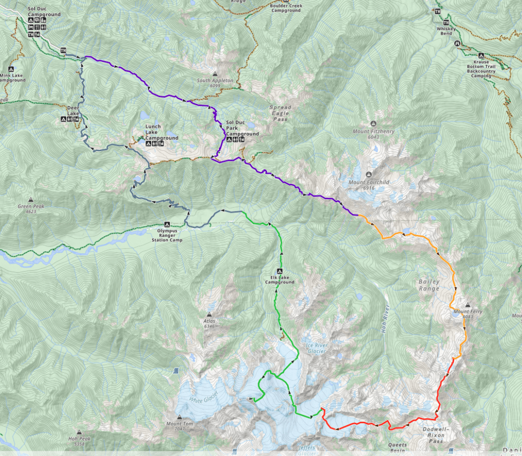
A map of the full Bailey Range traverse starting and ending at Sol Duc. On the map, each section of the five day itinerary is lined with a different color starting with day one in purple. We didn’t add the optional Olympus summit.
Day 1: Sol Duc to Eleven Bull Basin
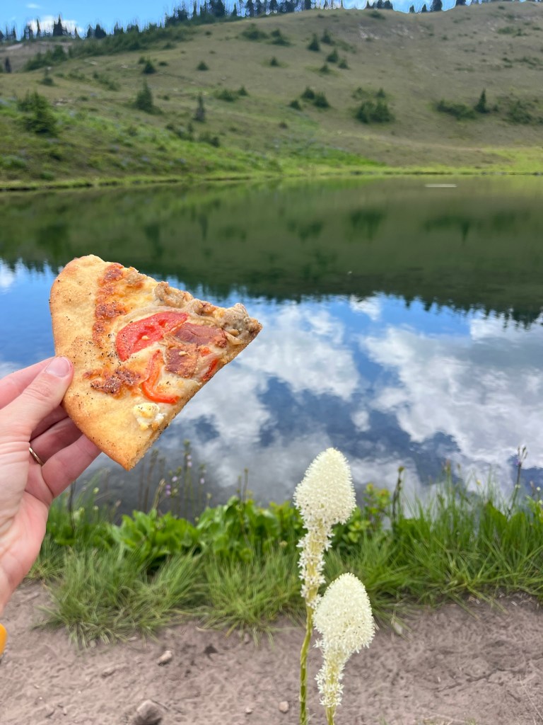
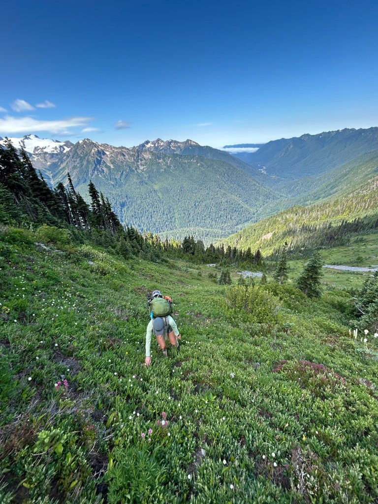
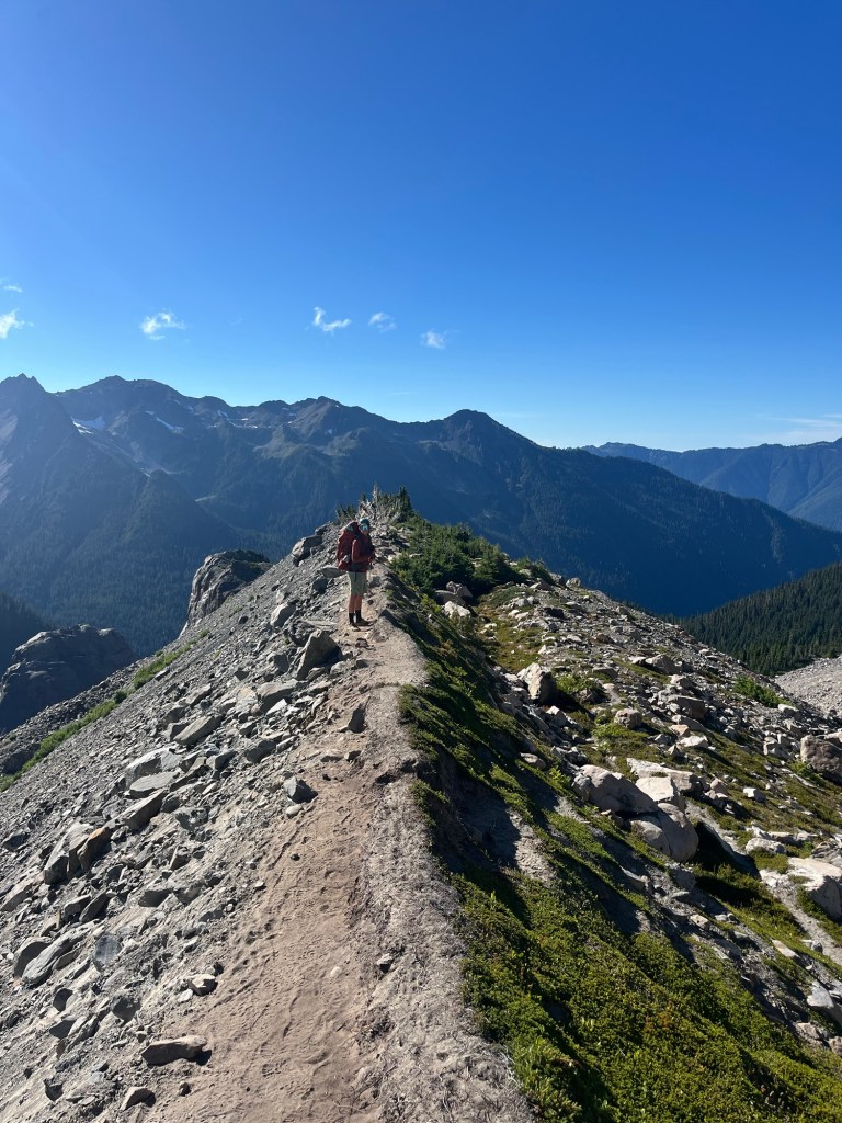
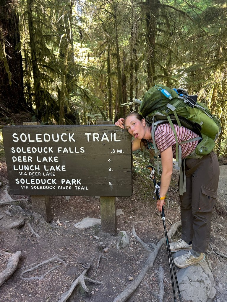
Part of the beauty of this route is that every day is distinct and beautiful in its own way. The trail out of Sol Duc up to the Seven Lakes Basin is a nice gradual climb through the trees that breaks out into the meadow around six miles in. We stopped at Heart Lake to refill water and eat some pizza for lunch before beginning our traverse of the Northern Baileys.
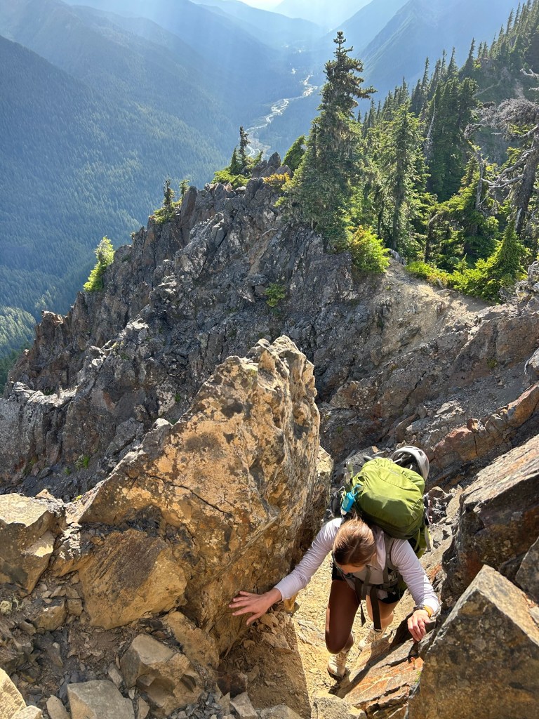
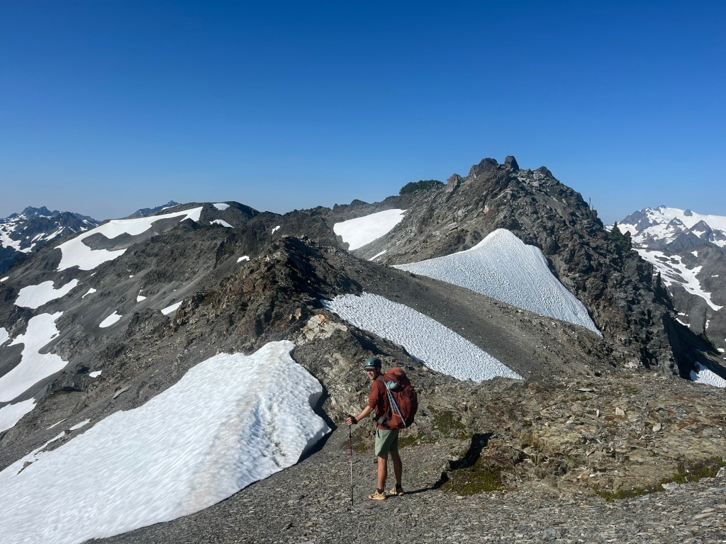
After leaving the Seven Lakes Basin, the first part of the traverse is still a decent trail until you reach ‘the catwalk’ and the first scramble of the trip. Little did we know how nice that solid rock would feel over the next few days of loose scree. Immediately beyond the catwalk we came to Boston Charlies which turned out to be a mosquito breeding pool. At least it made us glad to be pushing on to Eleven Bull Basin for our first camp!
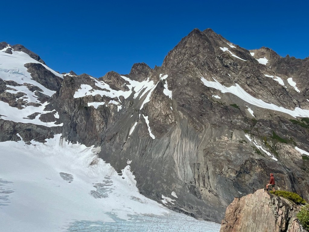
However, from that point forward the Northern Baileys truly begin. By that, I mostly mean that we spent the rest of the day side-hilling on a primitive path that crossed multiple gullies of small, loose scree. A few of the gullies were so washed out from recent rains that we used our ice axes to cut footholds across. If you looked down too long you could just make out the Hoh River 4000 feet below. If you fell, you probably wouldn’t stop sliding until you splashed in the river. This was undoubtedly Megan’s least favorite part of the trip and an uncomfortable way to start day one.
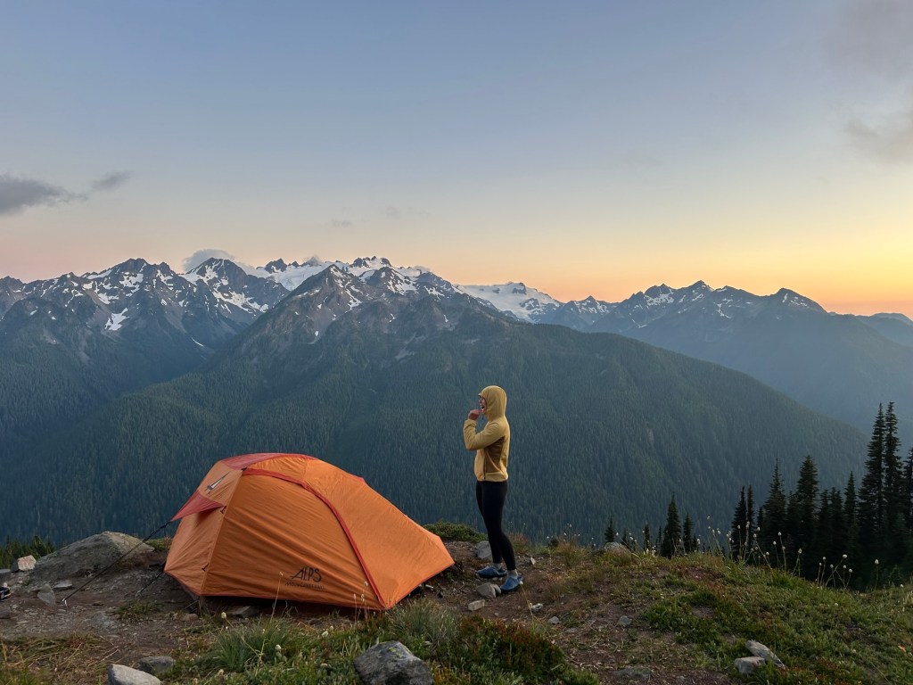
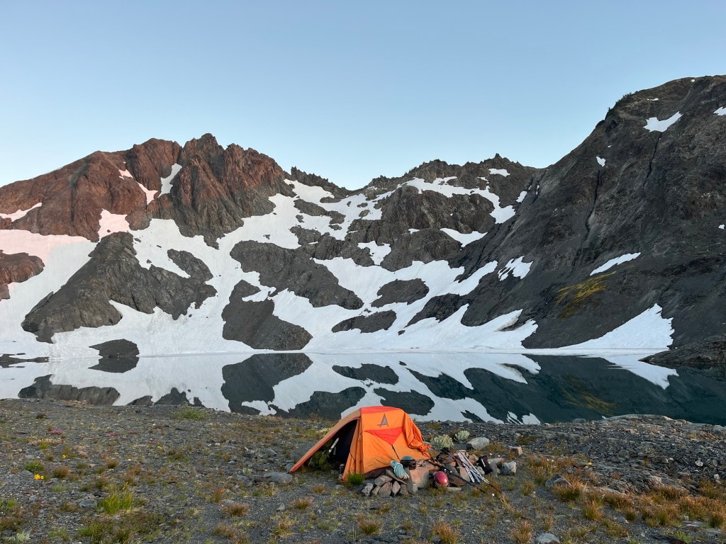
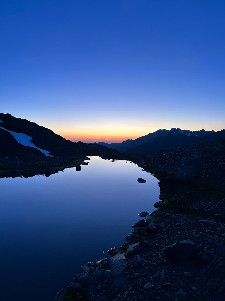
We were relieved to finally arrive at Eleven Bull Basin. Thankfully it turned out to be a lovely spot to lay our heads for the night with a nice stream nearby and great tent site on a knoll. As the sunset lit up the Olympic massif across the valley, we could trace our eyes across the entire route for the next fifty miles as the gentle evening light laid it out in front of us.
Day 1 Notes:
– We logged 12.5 miles and 5000 feet of elevation. The first 10 miles are on decent trail but the last 2.5 were slow going with the gully crossings.
– We heard later that an alternative to the awful scree gullies is to head up Mt. Carrie, traverse across the Fairchild Glacier and drop down to Stephen Lake after Mt. Ruth. Others we met later in the trip said that this was a nice route. The downside is that you generally camp at Boston Charlies instead of Eleven Bull, a prospect that seems pretty undesirable.
Day 2: Eleven Bull to Ferry Basin
The next morning we started back into the ‘aggressive side-hill with a serving of scree’ from the day before. The worst gullies of the entire trip may have been in the first miles of the morning. At this point the primitive trail comes and goes and we needed to decide where exactly we would cut up and over the hill to get to Lake Stephen. We choose a spot from the GPS and went for it. Up we go!
Lake Stephen was probably our favorite lake of the trip! As we glissaded a steep snow chute down into the basin, the turquoise shape of the lake became visible for the first time and I knew we had found our lunch spot. A bear eating berries across the lake agreed!
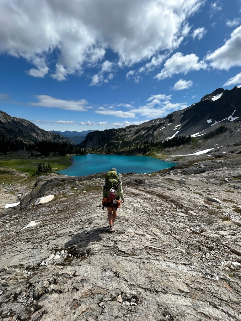
A splash in ice cold water and many calories later, we laid out on the smooth rock and relaxed for a catnap. It was heard to leave. We could have stayed at Lake Stephen all day but every time I looked up at the formidable Mt. Ferry and tried to imagine our route forward I got nervous. There simply did not look like there was any way in heck we could find a line up and over the mountain where the route should run.
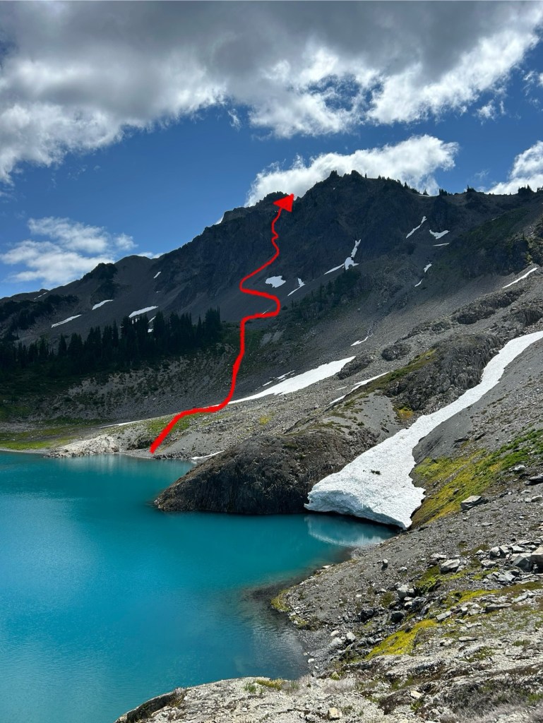
Well, time to find out if it goes. It was approximately 45 minutes later as we slowly climbed the wrong way up across some more awful scree that we chanced to look back and saw another group working their way up behind us. The only difference is they avoided the scree and were moving at three times our speed. Normally that would be annoying but in this case it was just relieving to see someone else out here and know that we were going the right way. After we chatted briefly, they pushed ahead and moved up the hill. That would turn out to be the only other people we would see until we regained the trail in several days. According to WTA only 50 people a year attempt this route. While I’m sure that number is quickly growing, running into another group still felt like an anomaly.
As it turned out, we were already through the worst of the climb up and over Stephen Peak when the other group passed us and we reached a low angle snowfield a few minutes later. From that point we started a slow but scenic descent towards Ferry Basin. The primitive footpath reappeared periodically and while it wasn’t easy it sure was pretty!
As we approached Ferry Basin I could tell it would be heavenly. Joyful little streams connecting the lakes run all over the gently sloping basin. Not for the last time I found myself wishing we had a rest day to enjoy it all.
We pushed on to the upper basin and the biggest of the lakes in the area to get as much distance as possible before we stopped for the evening. There was a great spot next to the lake where we set up camp. Mount Ferry is the eastern terminus of the Northern Baileys and the beginning point of the southern half. We were still nervous about the terrain to come but feeling great about having our first two days behind us.
However, the last adventure of the night was still to come. As dropped my pack in our camp spot I tweaked my lower back. It was so sudden and severe that I was stuck awkwardly, worried I would fall over but unable to move. Megan ran over and literally eased me to the ground where I lay in pain and unable to move for several minutes. Over the next two hours before bed my back loosened up a little but I was concerned. I could not bend over without shooting pain. Considering how hard the traverse had been up to that point, I started to get stressed and considered a bail route out Dodger Point.
Thankfully after a fitful night of sleep and a long morning stretch, I was able to get my pack on. As long as I stayed upright, it was doable. Painful, but doable. Thanks God!
Day 2 Notes:
– We logged just 6.3 miles and 2000 feet elevation on our first full day off trail. After ten hours of work, it was a shock to see how little we had moved.
– Apparently the ‘traditional’ route stays south of the ridge and drops down to Cream lake before Ferry Basin. Almost everyone says it’s an awful bushwack best avoided. I think I’d rather stick to the gorgeous Lake Stephen.
Day 3: Ferry Basin to the Humes Glacier to Ferry Basin
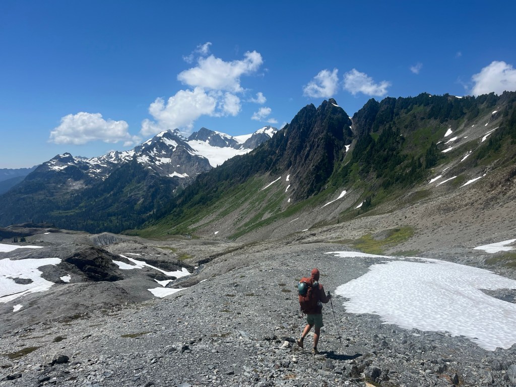
It’s hard to express the joy of traversing the Southern Baileys after the brushy, side-hill, gully-prone northern section. The smooth rolling miles from Ferry Basin to the Queets Basin are one of most wonderful stretches of hiking I’ve ever done. It’s a relatively straight forward ridge line with pure wilderness completely surrounding you. I felt incredibly free as we navigated our way over and around the towers of rock and ice that line the crest of the ridge. When we emerged at the wide open saddle of Bear Pass we were amazed at the landscape we were witness to. Huge snow fields stretched down into the valley on the west side of the pass while a 3000 foot drop yawned east of us. As a side note: I don’t understand why it’s called “Bear Pass” when one side of the ‘pass’ is a cliff…
The joy of the morning only grew as we crossed the snowfield to the ridge line above the Queets basin. A small stream and flat bench signaled that a well earned lunch time had arrived. Looking down the valley we could see where the rest of our day would lead us. At the bottom of the basin lies an especially tricky section to navigate. Steep cliffs, thick forest, and a river crossing are required to climb up to the toe of the Humes glacier and we had read more than one account that sounded harrowing. Most trip reports had labeled this section as the ‘crux’ of the route and I had a building trepidation as we prepared to head down and see what was in store.
We had read a lot of advice on how to navigate the next few miles and ultimately decided on following some GPS coordinates from someone who had done it the year prior. Those coordinates turned out to be a life saver. We managed to descend to the river via game trails and cross without too much difficulty before climbing an extremely steep embankment through thick foliage on the far side. Shortly after striking out in a generally right direction, we found a game trail the size of I-5 that took us a quarter mile. Throughout the trek I was amazed to see all the well established trails that result from the Olympic’s big game. That elk trail might have been the nicest path we walked for four days! A bit more bushwhacking, boulder hopping, and scrambling found us at the toe of the Humes glacier exhausted but generally grateful for how smooth the last section had gone.
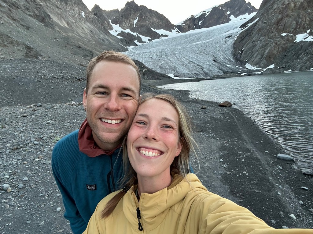
At the Humes we had a decision to make. We had been hoping to make it to Camp Pan, a legendary spot roosted above the Hoh glacier but 14 hours in to our day we decided to camp at the base of the Humes. We were worn and prospect of transitioning into our glacier gear at that point in the day sounded exhausting. Though I was disappointed to miss a night at Camp Pan, our spot at the base of the Humes turned out to be amazing. A cool breeze off the glacier kept away most of the bugs and the view was amazing. Throughout the evening chunks of the glacial wall across the lake would calve off with a huge splashes into the moraine. It was one of the more unique spots we have ever camped.
Day 3 Notes:
– We did 8.8 miles and 2200 feet of (tough) elevation.
– Overall I’m happy with the route we took from Queets Basin to the Humes. Without the GPX points from a WTA comment online we might have had a really rough go.
Day 4: Humes to Lewis Meadows
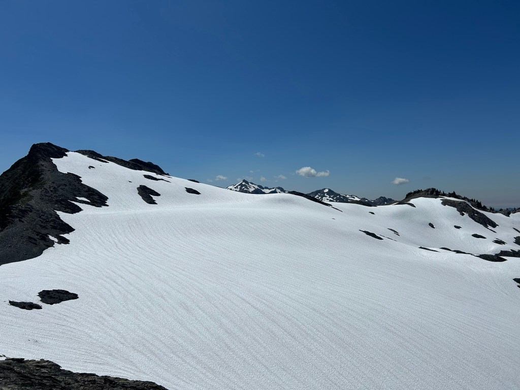
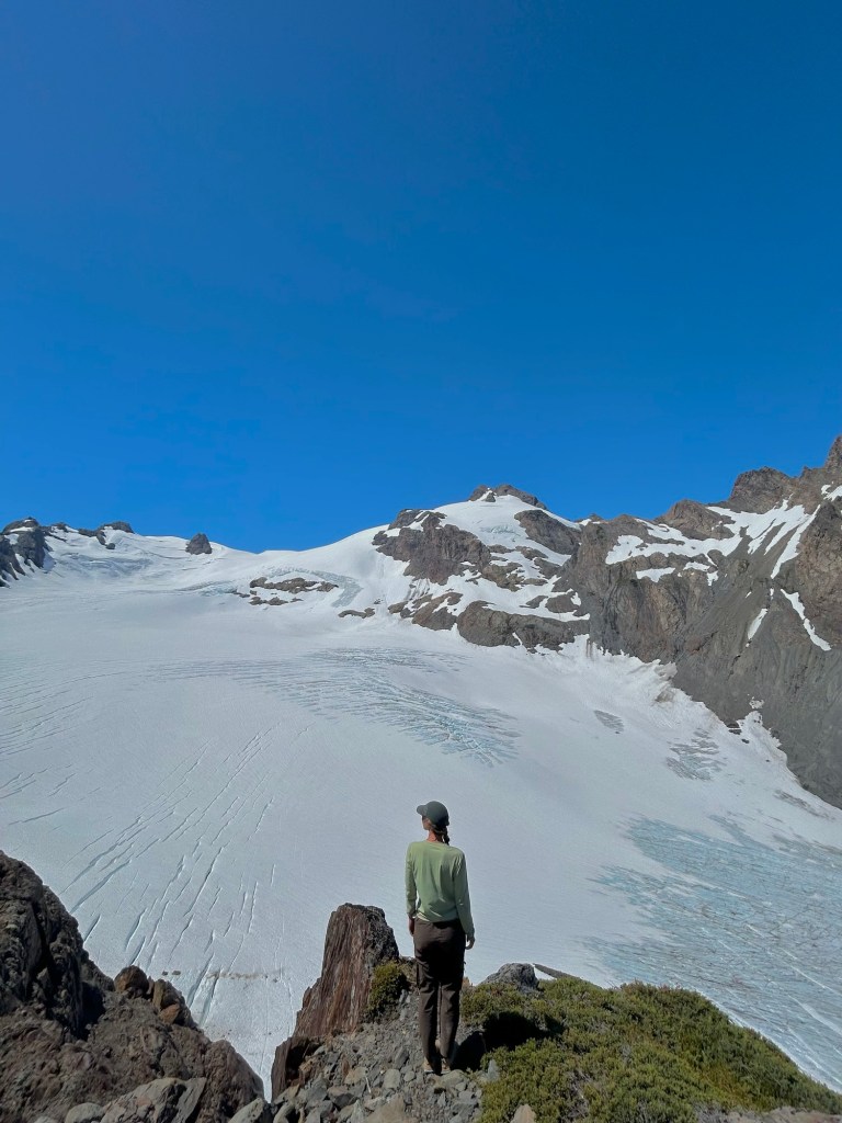
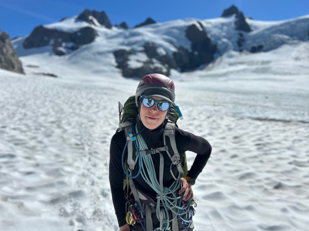
Each day of this trip brought its own challenge. As we woke up at the base of the Humes, we were feeling glad to have the crux of route behind us but still nervous for the full day of glacier travel ahead. We knew that if all went well we would regain a real trail towards the afternoon so we put on our glacier gear and started up the Humes. It was so cool to walk directly from dirt onto a glacier, a new and bizarre experience for both of us.
As it turned out, most of the day would be traveling across gently sloping glacier and was a lot of fun. However, when we approached our first pass of the day, Blizzard pass, the snow had melted out just enough to make the top of the pass a loose rock fiasco. It was just about a hundred vertical feet of scrambling on all fours and felt incredibly loose and stressful.
Once we made it over Blizzard we had a lovely but steep descent to Camp Pan, a spot I had been imagining for years. It did not disappoint.
Camp Pan is essentially a flat spur of rock with a few trees that sticks out hundreds of feet above the massive Hoh Glacier. There’s room for a few tents and a bit of running water nearby. With Olympus directly ahead and the Hoh Glacier stretched as wide as the blue sky above, I don’t know that we have ever been to such a majestic lookout. Though it was still early we decided to take a long lunch basking in the grand amphitheater.
We didn’t want to leave but after delaying as long as we could we headed down the steep cliff to the glacier. Megan and I have different perspectives on which parts of the trek proved to be the sketchiest. The gullies of the Northern Baileys were the worst for her. For me, the final 200 vertical feet descending from Camp Pan to the glacier is when I felt the most stressed. It’s just so steep and loose for the last section with no real footing. You have to go from ice to scree back to ice again with your crampons. Once again, we cut steps with our ice axes and made it through alive.
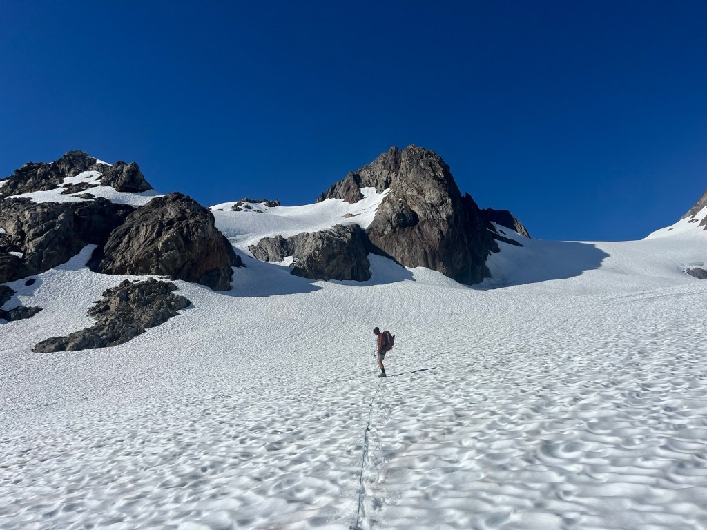
I started feeling better after we planted our feet on the enormous expanse of the Hoh. We weaved our way through the middle of numerous crevasses, only needing to cross two or three with an easy hop. The climb up Blizzard pass was a steep but fun slope, it’s firm snow a pleasant contrast to so much of the last four days.
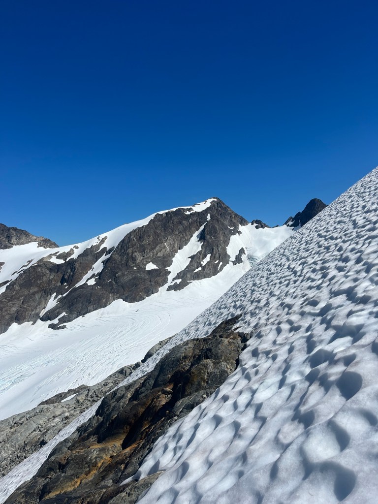
As we crested the pass, our view opened up down the Blue glacier all the way to where we knew we would meet up with the climber’s trail. I think we both began to breathe easier around that point. The gentle slope down gave us an incredible view of Olympus to our left. Our spirits rose high as we sensed that the hardest moments of the trip were likely behind us.
It’s hard to describe just how sweet the feeling of reaching the trail again at the lateral moraine felt. We were tired but the rest of our trip felt doable. That being said, I realized it was close to five in the evening and we still had another seven miles to go to reach our camp at Lewis Meadows!
A few miles down the trail we ran into the group we had been passed by on our second day. We found out they had added on an Olympus summit which allowed us to catch up to them. It was fun to compare notes on the route and we felt pretty cool when we found out they were volunteer search and rescue folks out having some fun together. Meeting that crew again turned out to be providential as our tired legs had miles still to go. We tucked in behind them and did our best to just stay in tow. A few hours later we said goodbye as we rolled into Lewis Meadows and crashed to sleep right as darkness fell completely.

legendary Camp Pan in the middle.
Day 4 Notes:
– We logged 12 miles but just 1000 feet of elevation. It was a long, 14 hour day.
– Some people, like our S+R friends add a summit of Olympus to this but it requires climbing the summit block, not something either of us can do. Next time!
Day 5: Lewis Meadows to Sol Duc
Our last day had us climb 4000ft out of Hoh River valley back up to the Seven Lakes Basin. It’s a big climb for the last day but honestly after the last few days, it was no big deal. A trail makes all the difference! We stopped for a lovely swim in Hoh lake where we saw an otter playing around. I’d never heard of an otter living at 5000ft but I guess it’s a thing.
Finally, we tagged Bogachiel Peak before continuing down the High Divide Trail back to our car. It was funny to run into crowds of people hiking the short distance to Sol Duc falls in the last mile after the pristine solitude of the trip, but it was a crowd we welcomed because it meant we were almost done.
Final Thoughts:
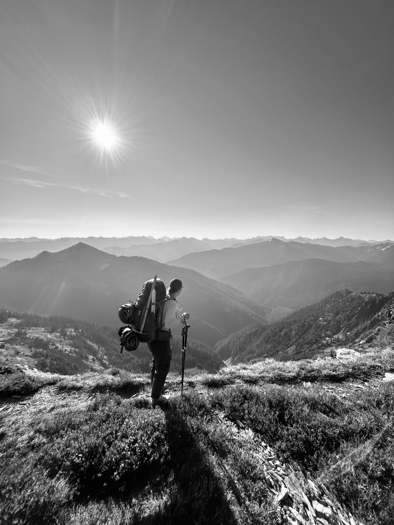
Luke: This was our first true off-trail adventure and I’m addicted. The freedom I’ve felt backpacking felt amplified by the off trail nature of the route. It was also hard, far harder than any backpack or climb I’ve done. Navigating the route was really fun and felt surprisingly natural, though we had a GPX route to keep us moving in the right direction as needed. Mentally, I was unprepared to go just 5-6 miles in a 10+ hour day and adjusting to off trail time and distance took a while to learn. Having the trail, ridge line, bushwhacks, and glacier travel all-in-one felt like a sampler plate of all my favorite backcountry things.
We learned a ton and made mistakes but over all things went pretty well for us. Ultimately, it’s my favorite route I’ve ever done and has me looking at similar traverses for the years ahead!
Megan: Mego comments here
Final Notes:
– We did about 55+ miles 23k elevation in total. Megan mostly tracked it on her watch but we missed a few sections. More importantly than the distance was the time. To put it in perspective, we were mostly moving at 2.5+ mph on easy trail but it took us an hour to go .25 miles in a few tough spots.
– I (Luke) read a lot of Climber Kyle’s blog and the Bailey Range was definitely inspired by his amazing write up and pictures.
– You do need a bear bin and glacier gear so our packs were heavier than I would have liked. In retrospect, it would be almost impossible to fall into a crevasse on this route but we came prepared!
– Shout out to our friends Connor and Erin in PA for letting us stay with them the night before, giving us pizza for trail lunch, and being our first shower off trail!

Leave a comment